


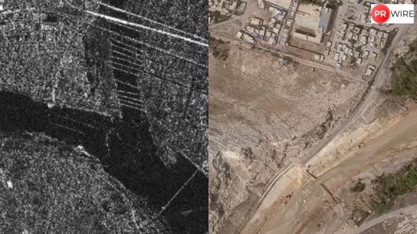


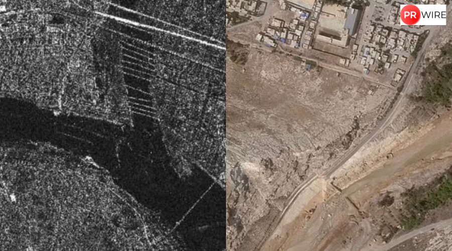
ISRO satellite images reveal a large debris deposit at confluence of Kheer Gad and Bhagirathi rivers, covering 20 hectares and engulfing houses.
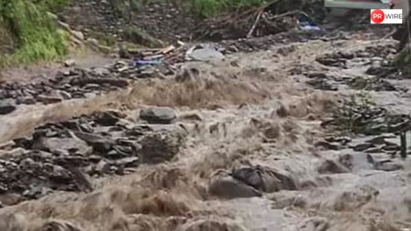
Days after two cloudbursts, one in Dharali and another in the Sukhi Top area in Uttarakhand’s Uttarkashi district, caused widespread destruction, the Indian Space Research Organisation (ISRO) released a satellite image showing the devastation around Dharali village following the flash floods.
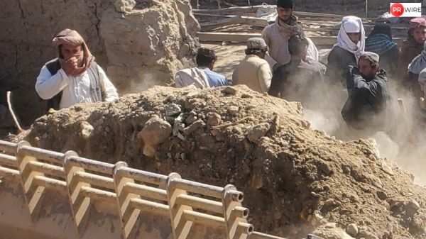
According to officials, at least four people have been killed in the disaster that struck the ecologically fragile area on Tuesday afternoon. Rescuers recovered two bodies on Wednesday, but it was not clear if these were among the four deaths reported the previous day.
Rescue operations gathered pace on Thursday as weather improved and more than 270 people stranded in different locations in the district were evacuated to safety with the help of IAF’s Chinook and Mi-17 helicopters. The army said 50 civilians are missing, besides nine of its personnel, including one junior commissioned officer. However, eyewitnesses said the number of missing persons could be even higher.
The ISRO used Cartosat-2S satellite imagery to perform rapid, side-by-side comparisons of before-and-after conditions (comparing data from June 13, 2024, to August 7, 2025).
Satellite Insights Aiding Rescue & Relief Ops
ISRO/NRSC used Cartosat-2S data to assess the devastating Aug 5 flash flood in Dharali & Harsil, Uttarakhand.
High-res imagery reveals submerged buildings, debris spread (~20ha), & altered river paths, vital for rescue teams on… pic.twitter.com/ZK0u50NnYF
— ISRO (@isro) August 7, 2025
In the latest image, a pronounced fan-shaped debris and sediment deposit, covering approximately 20 hectares, is visible where the Kheer Gad and Bhagirathi rivers converge. This deposit likely engulfed much of the village area, burying structures under mud and debris.
The flood dramatically altered the topography: river channels appear significantly widened and river morphology has visibly shifted, indicating the sheer force and sudden onset of the flash flood.
Many buildings and infrastructure in the floodplain seem partially or entirely submerged — some even appear to have disappeared from their pre-flood footprints.
“The satellite images would help the ongoing search & rescue operations to reach out to stranded individuals and restore connectivity to the isolated region, the ISRO said.
“The event highlights increasing vulnerability of Himalayan settlements to disasters. Scientific analysis is being carried out to ascertain the cause of the triggering event,” it added.
The article originally appeared on Hindustan Times